| |
 |
|
| ▲ Photos by Steve Oberhauser |
It took a grueling 12 hours of roundtrip travel time to set foot on Dokdo’s concrete landing strip for 20 minutes.
Having traveled as an impartial writer through much of Korea and Japan, I have no concerns about ownership of the disputed territory between the two countries in the East Sea (or the Sea of Japan depending on one’s take).
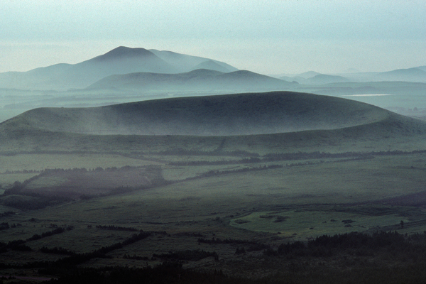
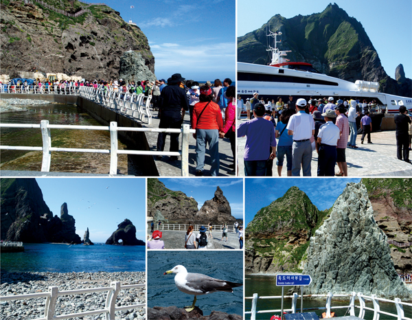
I observed beauty. Nothing more or nothing less of the two islets and 35 rocks, lying in abundant fishing grounds 215 kilometers east of the Korean mainland.
Part of another educational “workshop” with my high school’s Korean employees, 14 of us recently ventured on a four-day tour of the mainland, utilizing Korea’s multiple modes of transportation: airplane, mini-trot tour bus, taxi, gondola, tram, and the Ocean Flower ferry.
The Ocean Flower took us early one Monday morning first from Samcheok to Ulleungdo for a two-hour lunch break. Ulleungdo is some 135 kilometers east of the Korean mainland and is famous for dried squid, pumpkin taffy, and Chinese juniper woodcarvings. With roughly 10,000 inhabitants, the small fishing enclave is the stopping point before departing for Dokdo and on the return trip back from Dokdo to the mainland.
We boarded again out of Ulleungdo, the second of four section rides this day; about three hours later Dokdo was ours – for a very short time.
Getting off the Ocean Flower, the fervor was frenetically intense. Nationalism poured out of the ship in droves and snap-happy camera wielders started clicking instantaneously. All together, tens of thousands of pictures were easily taken in a matter of minutes. It was a camera advertisement waiting to happen. I landed at 3:31 p.m., dodged most of our group photos, got lost in the shuffle, tried to unsuccessfully blend in to the others and took scenery shots.
Upon being located, my superior asked, “Why would Japan think they own this?”
With the Korean flag flying high from a distant peak, a Korean meteorological and Coast Guard station, Korean lighthouse, a Korean-owned ferry docked, hundreds of Koreans looking around, Korean police officers in our presence and Korean pride pervading around the standardized Korean road sign reading “Dokdo Isabu-gil,” I remained silent. A Korean fisherman and his wife live on the rocky outcrop, as well. The total land area is 46 acres (187,450 square meters).
The politically correct term for the area is Liancourt Rocks. Claimed by both Korea and Japan, Korea administers Dokdo. Japan calls the area Takeshima. The claims for both countries go back hundreds of years, and a variety of historical evidence has been presented and argued ad nauseam to this day. The area is thought to hold large gas deposits.
Twice before this trip, a co-worker advised me to clear my mind and be in the middle of the group. That I could do, just follow and observe.
While this trip was being planned, another co-worker had asked me weeks before in the office, “Why do you think Japan continues to say Dokdo is theirs?”
Not sure, but I appeased him with a political bargaining chip answer.
At lunchtime on Ulleungdo, swilling traditional rice wine, the idea emerged and was discussed of traveling for some Koreans (and this foreigner) being half reality, half in a dreamlike trance opening the doors of perception. I agreed.
It required time to take in Dokdo’s visit. There was a poet in our travel group. The next day at one of the largest caves in Asia, Hwanseongul in Gangwando, we witnessed the power of forceful flowing natural water inside. Being metaphorically cleansed, he revisited the question: “Who ordered the [perfect] weather on Dokdo?”
Again, not sure, but I’ll remember the mental pictures of Dokdo, the painting created in my head … and the scorching sun baking the concrete and weathering my skin, with no worries about ownership. Experiencing Dokdo and nature is free of national boundaries.
|


